How to Identify Countries from Satellite Images
Learn to recognize countries and regions from aerial and satellite views. Master terrain patterns, coastlines, urban layouts, and geographic features for Zoom Challenge success.
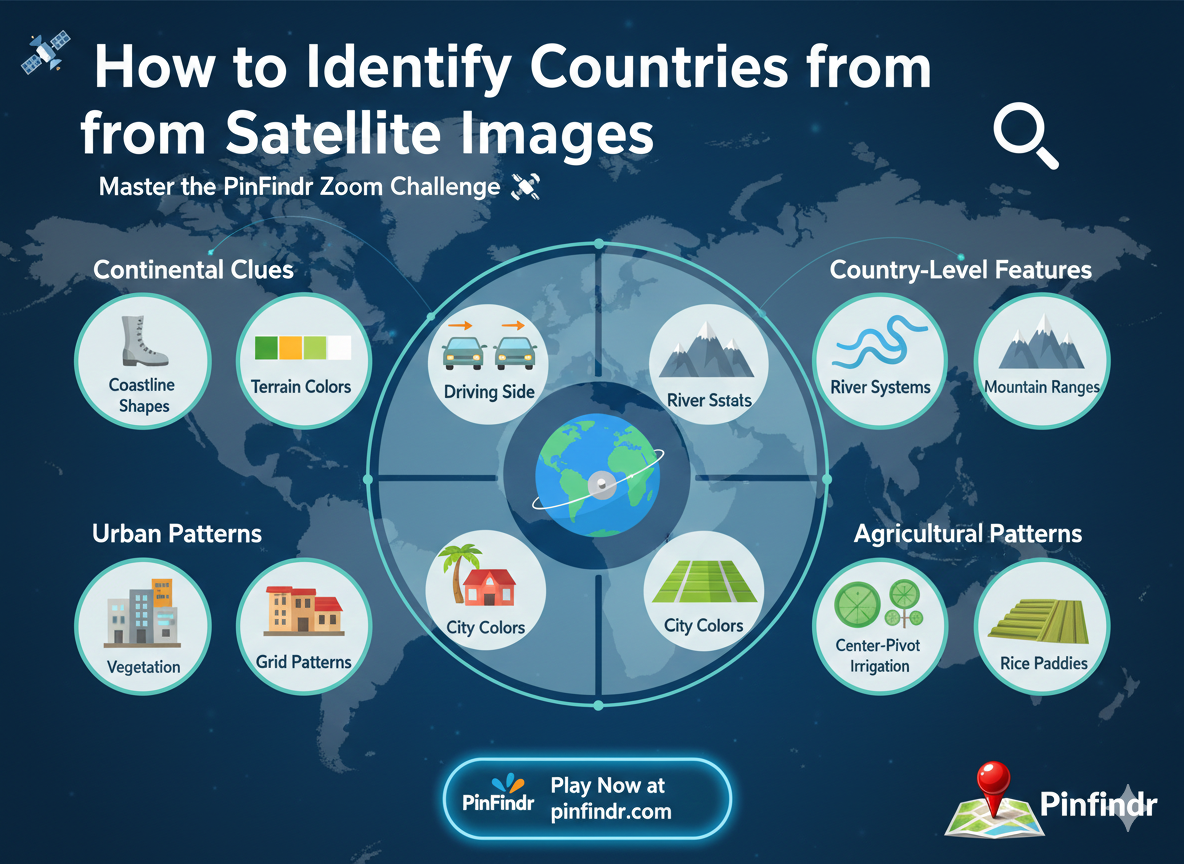
How to Identify Countries from Satellite Images 🛰️
PinFindr's Zoom Challenge mode tests a unique skill: recognizing locations from a bird's-eye view. The satellite image slowly zooms in, and the earlier you guess correctly, the more points you earn. Here's how to master this challenging mode.
Understanding the Zoom Levels
The Zoom Challenge progresses through several zoom levels:
- Continental view — You can see entire continents
- Regional view — Country shapes and major features visible
- City view — Urban areas and road networks appear
- Street view — Individual buildings and streets become clear
The key is making your guess as early as possible for maximum points.
🌍 Continental Clues (First Zoom Level)
At the widest zoom, look for:
Coastline Shapes
- Boot shape → Italy
- Hexagon → France
- Peninsula pointing south → India or Korean Peninsula
- Island continent → Australia
- Horn shape → Horn of Africa (Somalia/Ethiopia)
Terrain Colors
- Bright green → Tropical regions (Amazon, Congo, Southeast Asia)
- Yellow/tan → Desert (Sahara, Arabian Peninsula, Gobi)
- White → Snow/ice (Arctic, Antarctic, high mountains)
- Dark green → Temperate forests (Central Europe, Eastern USA)
- Red/orange soil → Australia outback, Brazilian cerrado, African laterite
🗺️ Country-Level Features (Second Zoom)
River Systems
Rivers are excellent identifiers:
| River Pattern | Location |
|---|---|
| Nile (long, single line through desert) | Egypt/Sudan |
| Amazon (massive, branching through green) | Brazil |
| Mississippi (central, winding) | USA |
| Danube (flowing through multiple countries) | Central/Eastern Europe |
| Ganges Delta (massive fan shape) | Bangladesh/India |
Lake Patterns
- Great Lakes → USA/Canada border
- Lake Victoria → East Africa
- Caspian Sea → Central Asia
- Lake Baikal (crescent-shaped) → Siberia, Russia
Mountain Ranges
- Wrinkled terrain with snow caps → Alps, Himalayas, Andes
- Long ridge running north-south → Andes (South America) or Rockies (North America)
- East-west ridge → Alps (Europe) or Himalayas (Asia)
🏙️ Urban Patterns (Third Zoom)
City layouts reveal continents and even specific cities:
Grid Patterns
- Perfect grid → American cities (New York, Chicago), planned cities
- Radial/circular → European cities (Paris, Moscow)
- Irregular/organic → Old Asian and Middle Eastern cities
- Mixed grid + organic → Latin American cities
City Colors from Above
- Gray rooftops → Northern Europe
- Terra cotta/red roofs → Mediterranean (Spain, Italy, Southern France)
- White/light roofs → Middle East, North Africa
- Blue/green roofs → East Asia (especially Japan)
- Tin/metallic roofs → Developing regions
Highway Patterns
- Massive interchange cloverleafs → USA
- Roundabouts → Europe (especially France, UK)
- Ring roads → European capitals (Moscow, Berlin, Paris)
🌾 Agricultural Patterns
Farming is visible from space and varies dramatically:
- Center-pivot irrigation circles → USA, Saudi Arabia, Libya
- Rectangular fields → Europe, USA Midwest
- Irregular small plots → Southeast Asia, Sub-Saharan Africa
- Rice paddy terraces → China, Vietnam, Indonesia, Philippines
- Vineyard rows → France, Italy, California, Chile
🏜️ Terrain Types
Deserts
- Sand dune seas (erg) → Sahara, Arabian Desert, Namib
- Rocky desert (reg) → Iran, Central Australia
- Salt flats → Bolivia (Salar de Uyuni), USA (Bonneville)
Forests
- Dense, uniform green → Amazon, Congo, Borneo
- Coniferous (darker green) → Scandinavia, Canada, Siberia
- Deciduous (lighter, patchy) → Western Europe, Eastern USA
Coastlines
- Coral atolls → Pacific Islands, Maldives
- Fjords → Norway, New Zealand, Chile
- Mangrove coastlines → Southeast Asia, West Africa, Florida
- Straight sandy beaches → Australia, Brazil, West Africa
🏔️ Quick Reference: Unique Landmarks from Space
Some locations are instantly recognizable:
- Palm Islands → Dubai, UAE
- Circular city → Moscow (ring roads)
- Star-shaped fortification → Various European cities
- River splitting into many channels → Delta regions (Bangladesh, Netherlands, Vietnam)
- Giant dam → Three Gorges (China), Aswan (Egypt), Itaipu (Brazil/Paraguay)
🎯 Strategy for Maximum Points
- First 3 seconds: Identify the continent from terrain color and shape
- Next 5 seconds: Look for distinctive features (rivers, mountains, coastlines)
- Zoom level 2: Narrow to country using unique patterns
- Zoom level 3: If you see urban area, identify city from layout
- Make your guess early — Waiting too long costs more points than guessing approximately correct
When to Guess Early vs. Wait
- Guess immediately if you recognize a distinctive coastline or feature
- Wait one zoom level if you've narrowed it to 2-3 possible countries
- Never wait until final zoom — by then, points are minimal
Practice Makes Perfect
The best way to improve at satellite recognition is repetitive practice. Play PinFindr's Zoom Challenge daily and you'll start recognizing patterns that seemed invisible before.
After 50 rounds, you'll notice you can identify continents in seconds. After 200 rounds, many countries become instantly recognizable. After 500 rounds? You might surprise yourself by identifying cities from the very first zoom level.
Ready to test your satellite vision? Head to PinFindr Zoom Challenge and start training! 🛰️